
Community
Ken Barlow is forecasting a warmer and drier day today
By Marcus Chen
Advertisement · Why this ad?
Katherine oversees editorial operations across all six brands. Before joining The Meridan Group, she spent 14 years at the Minneapolis Star Tribune, where she led the metro desk through its digital transformation. She holds a Master's in Journalism from Northwestern's Medill School.
More from Katherine →As Minnesotans prepare for a warm October day, an alert from Ken Barlow signals that the tranquility may soon give way to severe weather. The impending thunderstorms are not just a meteorological concern; they represent a shift in the community's daily rhythm, prompting families and individuals across the Twin Cities metro to adjust plans and prioritize safety.
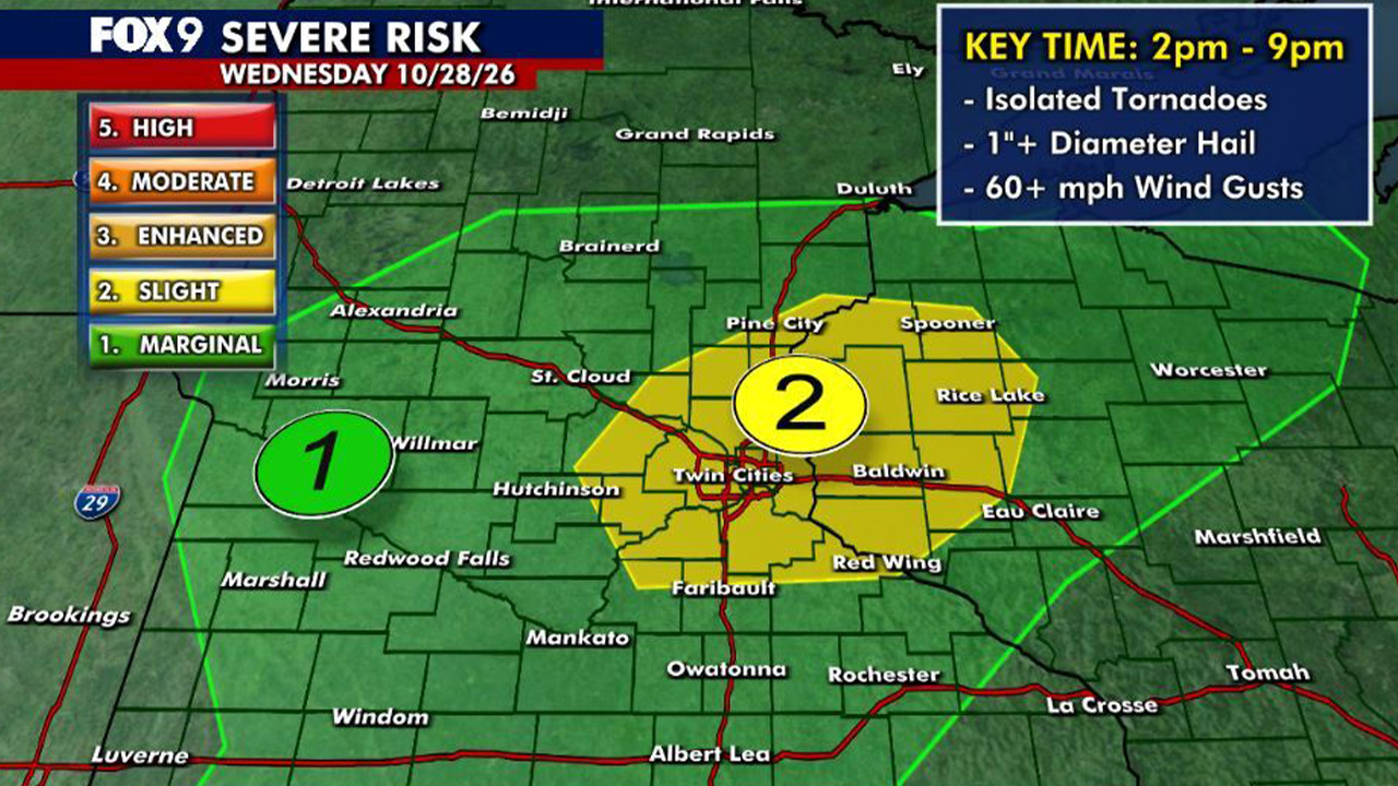
Ken Barlow, a trusted voice in local weather reporting, has issued a Minnesota’s Weather Authority Alert for possible severe thunderstorms across the state today, Wednesday. This critical advisory highlights the potential for rapidly changing conditions that could impact commutes, after-school activities, and evening plans, particularly for residents in Edina and the broader west metro area.
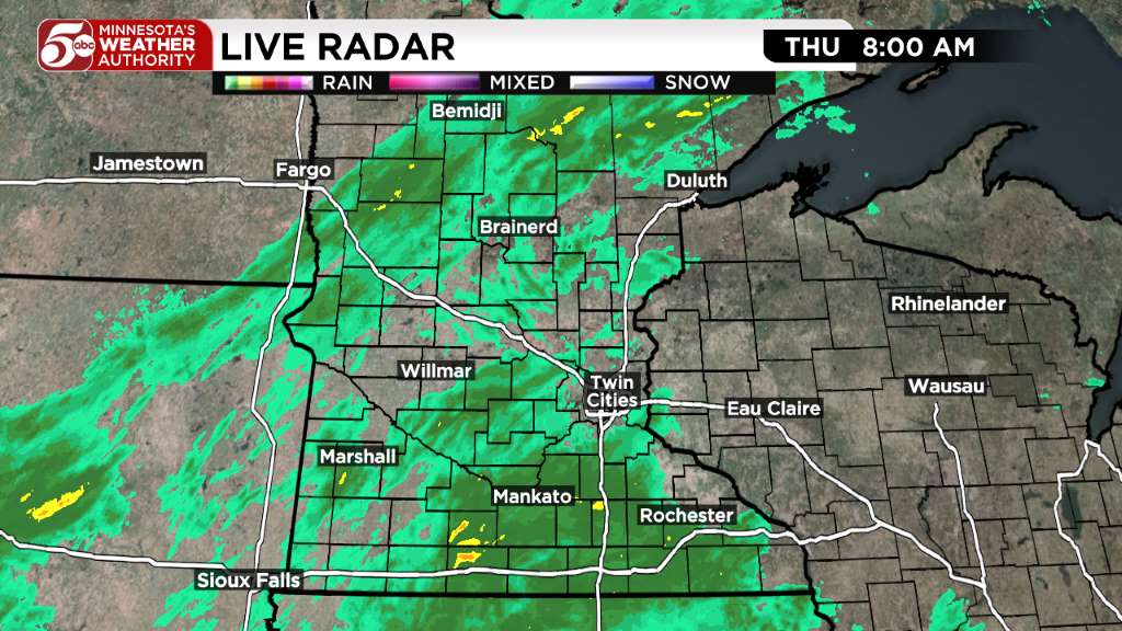
The alert specifies that severe thunderstorms are possible this afternoon and early evening. Forecasters predict that a line of showers and thunderstorms will begin to develop to the west of the Twin Cities around midday. These initial systems are expected to intensify as they track eastward, moving into the west metro area after 3 PM.
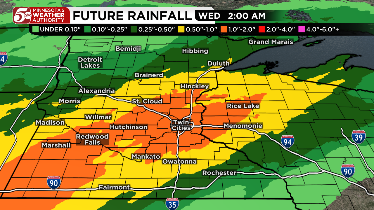
Residents should prepare for these storms to move through the entire metro region during the critical afternoon and evening drive times. The potential hazards are significant and include heavy rain at times, hail, wind gusts exceeding 60 mph, and even isolated tornadoes. Such conditions can quickly make travel hazardous and pose risks to property and personal safety.
Adding to the complexity, today is also projected to be the warmest day of the week. Temperatures this afternoon are expected to rise quickly, reaching well into the 60s and even the lower 70s across the state. This unseasonably warm air, a stark contrast to the normal late October temperatures which typically only reach the lower 50s, contributes to the atmospheric instability conducive to severe weather.
For residents of Edina, this weather alert from Minnesota's Weather Authority is a critical advisory. As a central part of the west metro, our community is directly in the path of the anticipated severe thunderstorms this afternoon and evening. Prudent preparation, ensuring the safety of our families and homes, is paramount as we navigate these conditions together. The City of Edina Official Website remains a key resource for local updates and emergency information.
Families making plans for Halloween, just a few days away, may find themselves adjusting their schedules and keeping a close eye on the forecast. The potential for severe weather underscores the importance of staying informed and safe in a community known for its active engagement in local events and strong family values. Ensuring that homes are secure, outdoor items are stowed, and emergency kits are accessible are practical steps every household can take.
Local authorities, including those in Hennepin County, are monitoring the situation closely. Parents should consider how school dismissal times and after-school activities might be affected. The Edina Public Schools website is a good place to check for any announcements regarding school operations or event cancellations due to weather.
With the threat of high winds and potential tornadoes, it's crucial to have a plan. The Ready.gov website offers comprehensive guides on preparing for severe weather, including tips for creating an emergency kit and establishing a family communication plan. Knowing where to take shelter in your home or workplace is vital, especially if a tornado warning is issued.
Power outages are also a possibility with severe storms. Residents should ensure their cell phones are charged and have flashlights and extra batteries readily available. Information on outages and restoration efforts can often be found on utility provider websites, such as Xcel Energy, which serves much of the Twin Cities metro.
The National Weather Service Twin Cities office provides the most up-to-date meteorological information and warnings. Staying tuned to their updates via their official website or local news channels is highly recommended. The American Red Cross also offers valuable resources for disaster preparedness and safety tips.
While today brings the immediate concern of severe weather, the forecast for the rest of the week offers a brighter outlook. Thursday and Friday are expected to be the brightest days of the week, with temperatures once again rising into the 50s and 60s. This return to milder, sunnier conditions will be a welcome change after today's potential turbulence.
Halloween on Saturday does not look too bad either. While there might still be a few rain showers at times, forecasters do not anticipate a washout. This is good news for families looking forward to trick-or-treating and community gatherings. Temperatures are expected to be mild, near 60 degrees, when the sun sets around 6 PM, creating a pleasant atmosphere for children and families to enjoy the festive evening.
As the weekend concludes, Minnesotans will also observe the end of Daylight Saving Time. Don’t forget to ‘fall back’ an hour before going to bed Halloween night, as Daylight Saving Time officially ends at 2 AM on Sunday. This annual ritual reminds us of the changing seasons and the steady rhythm of life in our resilient communities.
The tension between the warmth of a late October day and the looming threat of severe weather reflects the community's resilience in the face of nature's unpredictability. As the sun sets on Halloween, families will gather, hoping for clear skies, while the reminder to 'fall back' echoes the rhythm of life in Minnesota, where community and weather are inextricably linked. For broader emergency planning, resources from the Federal Emergency Management Agency (FEMA) and the Centers for Disease Control and Prevention (CDC) offer additional guidance for all types of emergencies, reinforcing the importance of preparedness for every household.
Staying informed through official channels like the State of Minnesota's website and taking proactive steps to prepare are the best ways for families to navigate the challenges of today's forecast. Our community's strength lies in its ability to come together, support one another, and ensure the safety and well-being of every family, preserving the bedrock of our shared values.
By Marcus Chen
By Katherine Langford
By Katherine Langford
By Katherine Langford